SNOTEL (Snow Telemetry)
From Signal Identification Wiki
 | |
|---|---|
| Frequencies | 40.67 MHz |
| Frequency Range | 40.67 MHz - 40.67 MHz |
| Mode | NFM |
| Modulation | PSK |
| ACF | — |
| Emission Designator | — |
| Bandwidth | 9 kHz |
| Location | United States |
| Short Description | SNOTEL stations are a set of precipitation and other sensors spread across the mountains of the United States by the Department of Agriculture through the National Resources Conservation Service. |
| I/Q Raw Recording | Download file |
| Audio Sample | |
SNOTEL stations are a set of precipitation and other sensors spread across the mountains of the United States by the United States Department of Agriculture through the National Resources Conservation Service. The SNOTEL website can be found here and includes a map of all of the stations.
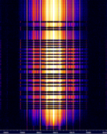
The signal itself uses very short bursts of BPSKBinary Phase-Shift Keying (1 bit per symbol) data at 4000 bits per second. Since the stations are in remote locations, sometimes in deep mountain valleys, they use meteor scatter propagation to best get their data back to a base station.